


Popularized paper text published in VIMA Science (To VIMA tis Kyriakis, 5/3/2023), regarding the summer flowering of the capper, a research carried out by the Laboratory of Biogeography & Ecology. The original paper: Kantsa A., Garcia J., Raguso R., Dyer A., Steen R., Tscheulin T., Petanidou T. (2023). Intrafloral patterns of color and scent in Capparis spinosa L. and the ghosts of its selection past. American Journal of Botany, 110:e16098.

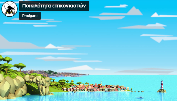
The sea and the maritime space play a decisive role in the evolution of cultures, nations, the arts and humanity in general. This collective volume aspires to contribute to the dialogue on contemporary spatial issues and challenges associated with maritime spatial planning, with a view to protecting the environment and the development of the seas. In this respect, several examples from various Mediterranean countries are presented and discussed.rnrnIn the first part of the volume, the contributions present geopolitical and spatial challenges, issues related to the “territorialization” of the sea and a relatively new approach that focuses on maritime spatial planning and floating offshore “marine-urban” settlements. The contributions contained in the second part of the volume present a number of applied approaches to Maritime Spatial Planning from Cyprus, Spain and Slovenia, while special reference is made to the case of Greece. This volume is a modern applied planning tool for researchers, students and other interested parties, highlighting important issues and particularities that characterize Maritime Spatial Planning in the Mediterranean countries.

An important award was received by Associate Professor St. Gialis and postdoctoral researcher K. Gourzis from the journal “European Urban and Regional Studies”, for their article "Inter-regional underemployment and the industrial reserve army: Precarity as a contemporary Greek drama", which they co-authored with Professor A. Herod from the University of Georgia. The journal awarded the paper the Jim Lewis Prize as the most innovative paper of 2022.
In the frame of the European project LIFE 4 Pollinators we produced simplified guides in Greek for the identification of insects and plants, together with a video.

The Documentary “Xerolithia” directed by Stelios Charalampopoulos received the 1st Odysseus Award at the International Epidaurus Film Festival. The 30min documentary was produced by the University of the Aegean within the project LIFE TERACESCAPE.

The exhibition entitled “Terraces of the Aegean: pictures from the past to the future”, was launched on September 10 in Chora, Andros Island. Exhibits include a setup of cultural products resulted from events and activities performed in the frame of the European project LIFE TERRACESCAPE (2017-2022) – food for thought (and action!) for our future!

Article published in the newspaper ΤΟ ΒΗΜΑ (Sunday edition, BHMA SCIENCE, 3 July 2022) regarding a Citizen Science activity by members of the Laboratory of Biogeography and Ecology, carried out in Arnaia, Chalkidiki, in the frame of the European project LIFE 4 POLLINATORS.

The Conference, to be held in the frame of the project LIFE TERRACESCAPE (LIFE16 CCA/GR/000050, aims at informing local and national authorities about the achievements of the project (2017-2022). The coordinating team, namely the University of the Aegean, together with representatives of the five project partners (Green Fund, Municipality of Andros, National and Kapodistrian University of Athens, National Observatory of Athens, and Hellenic Agricultural Organization – Demeter) will uncover the positives to be further transferred to the society and discuss the challenges of a very ambitious project!

In recent years, maritime spatial planning has attracted the interest especially of scientists and staternadministrations as it is now a widely accepted vision of a development process.rnMaritime spatial planning must respond in a distinct way to current and future needs and challenges, address problems and conflicts, and lay the foundation for effective protection of the natural and man-made environment, with a view to development and intergenerational solidarity

This book, the result of an international research project, explores the traits of austerity urbanism in eight cities, centring on the themes of Rescaling, Collaborative Governance, Political Resistance, Cultural Diversity and Migration.

The Drystone School of Andros Island was concluded with high spirit and enthusiasm albeit the external difficulties (extremely bad weather, covid-19 etc.). The School was installed at the ancient path connecting the new paved road (near the Holy Trinity chapel) with the Archaeological Site of Ancient Zagora. A total of ca. 100 m of walls were demolished and rebuilt along the free stone wall fencing the path which is now halfway restored (ca. 1000 m out of its ca. 2000-m entire length).

This is an interview of Theodora Petanidou to Giorgos Lialios (Kathimerini newspaper) inspired by the talk she has delivered to the Special Permanent Committee on Environmental Protection of the Greek Parliament on 20/01/2021.

Theodora Petanidou’s inteview to cyclades open on the subject of the Project LIFE TERRACESCAPE with emphasis on the 1st Drystone School of Andros carrie dout in November 2021 and on other environmental issues related to the Aegean and its inhabitants of today.

This collective volume engages with contemporary scientific advances in the interdisciplinary scientific area of Landscape and Tourism. It represents the product (special issue) of a series of research studies published in the journal Land, aiming to enhance interdisciplinary dialogue on the multifaceted and complex relationship Landscape-Tourism, highlighting pertinent contemporary issues and future challenges, and establishing the significance of development of relevant theory, epistemology, empirical application, policy and ethics. This open-access volume comprises of 16 research articles and an Editorial article on the Landscape-Tourism interrelationship, coming from and/ or representing applications in various countries and covering the entire spectrum of such contemporary scholarly inroads.

Την Πέμπτη 16 Δεκεμβρίου 2021 το Εργαστήριο Χωρικής Ανάλυσης, Συστημάτων Γεωγραφικών Πληροφοριών και Δορυφορικής Τηλεπισκόπησης (SAGISRS), του Τμήματος Γεωγραφίας, του Πανεπιστημίου Αιγαίου, εγκατέστησε στο κτίριο του Επιμελητηρίου Λέσβου, 'έξυπνες συσκευές' (θερμοκρασία, υγρασία, ποιότητα αέρα, κ.α.).«έξυπνες συσκευές» με αισθητήρες για την παρακολούθηση και τη καταγραφή περιβαλλοντικών τιμών (θερμοκρασία, υγρασία, ποιότητα αέρα, κ.α.). συνεχίζοντας τις δράσεις του, στο πλαίσιο υλοποίησης του Ερευνητικού προγράμματος Πράσινο Ταμείο: «ΦΥΣΙΚΟ ΠΕΡΙΒΑΛΛΟΝ ΚΑΙ ΚΑΙΝΟΤΟΜΕΣ ΠΕΡΙΒΑΛΛΟΝΤΙΚΕΣ ΔΡΑΣΕΙΣ 2020», Άξονας προτεραιότητας 2: Καινοτόμες Δράσεις – Έξυπνες Πόλεις με τίτλο Έξυπνες Συσκευές Καταγραφής Περιβαλλοντικών τιμών για Δημόσια Κτίρια.Το έργο στοχεύει στην έξυπνη παρακολούθηση περιβαλλοντικών παραμέτρων εντός και εκτός των δημόσιων κτιρίων, πληροφορώντας το κοινό και τη διοίκηση ώστε να λαμβάνουν αποφάσεις για την καλύτερη διαχείριση πόρων όπως θέρμανση, φωτισμός, εξαερισμός κ.α.rnrnΟι συσκευές που εγκαταστάθηκαν στον ανακαινισμένο και πλήρως υλικοτεχνικά εξοπλισμένο συνεδριακό χώρο του επιμελητηρίου, είναι διακριτικές στο χώρο (δεν θα επηρεάζουν την αρχιτεκτονική και αισθητική του κτιρίου), ασφαλείς τόσο ως προς την χρήση τους, όσο και απέναντι στους παρευρισκόμενους στο κτίριο καθώς και στο περιβάλλον. Οι έξυπνες συσκευές σχεδιάστηκαν και κατασκευάστηκαν στο Πανεπιστήμιο Αιγαίου στη Μυτιλήνη, αξιοποιώντας τεχνικές “Διαδικτύου Των Πραγμάτων” (Internet of Things).rnrnΠαράλληλα, η ερευνητική ομάδα του εργαστηρίου που αποτελούνταν από τον Επιστημονικό Υπεύθυνο του έργου, Επίκουρο Καθηγητή Δ. Καβρουδάκη, και τους υποψήφιους διδάκτορες Παναγιώτη Αγουρόγιαννη, Μάριο Μπάτσαρη και Σοφία Ζαφειρέλλη, πραγματοποίησε συνάντηση με τον κ. Ευάγγελο Μυρσινιά, Πρόεδρο του Επιμελητηρίου Λέσβου και συζήτησαν για συμβολή της ενεργειακής αναβάθμισης των κτιριακών εγκαταστάσεων του επιμελητηρίου και τη χρήση «έξυπνων μεθόδων» για την παρακολούθηση περιβαλλοντικών τιμών σε πραγματικό χρόνο, που θα βοηθήσει σε ορθολογική διαχείριση και εξοικονόμηση πόρων.

The book "Spatial Planning and Challenges - New spatial thinking in Greece and France" raises concerns about the future of Greece. It aspires, through the exchange of experiences between France and Greece, and through different topics, concerning conceptual and methodological issues, such as issues of maritime spatial planning, landscape, tourism activity and spatial governance, but also issues related to the new challenges of industry - , to lay the foundations for a "new spatial thinking". It consists of texts by scientists specializing in spatial planning issues. All contributions are both in Greek and French. The book highlights the importance of spatial planning for the development of the country, - an issue that is now a widely accepted view - Spatial planning is a key tool for returning to normalcy, after more than one decade of generalized economic and social crisis. It is also emphasized that in any successful development effort, spatial planning is among the key actions planned and implemented. Spatial planning is considered as a means of achieving optimal economic efficiency, ensuring social cohesion, and sustainable management, of the environment for a specific sosio-spatial system.
The book presents a critical overview of the framework of spatial planning in Greece during its twenty years of implementation. It focuses on the need for spatial planning to be a priority policy, to ensure a decisive role in the development model of the country, and to be a key parameter of a modern democracy. Spatial planning should not be treated as an inactive policy, or a bureaucratic obligation of the state which, however, has neither the political will, nor the necessary means to implement it. Finally, the need for the development of spatial thinking in Greece is emphasized. It is also recognized that “planers” should conceive new ideas, in order to promote effective management of modern problems, giving a perspective on the sustainable development of Greece.

LTER (Long-Term Ecosystem Research) is an international network supporting long-term ecosystem research. Lesvos Biodiversity Observatory is one of the first eight observatories established in Greece so far.

A concise book on the terraces of the Aegean, which was written as part of the educational material in the frame of the project LIFE TERRACESCAPE: Employing land stewardship to transform terraced landscapes into green infrastructures to better adapt to climate change (LIFE16 CCA/GR/00050).

The paper explores the traits of austerity governance and social policy in the city of Athens during the turbulent last decade.

Celebratory event of Landscape Research Group and discussion panel in honor of Professor Yi-Fu Tuan, with the title “The Legacy of Yi-Fu Tuan”, 10/12/2020, Organizer: Theano S. Terkenli, Department of Geography, University of the Aegean. Panelists: Nicholas E. Entrikin, Tim Cresswell, Karen Till, Paul C. Adams, Theano S. Terkenli and Yi-Fu Tuan.

In the context of its Events Series, the Center for Hellenic Studies of Harvard University organized the event with the title “Interpretations of the Greek landscape”. The event was in the form of an online panel discussion via Harvard Zoom, open to the public, and took place on Wednesday, May 26th 2021, at 19:00. The video of the event is located at https://www.youtube.com/watch?v=Vv9PbPhqQ4g&ab_channel=CHSGreece. The panel discussants were: Theano S. Terkenli, Yiannis Aesopos, Yiannis Peponis

Εικόνα του εξωφύλλου είναι μία παραλλαγή φωτογραφίας του βραβευμένου φωτογράφου Γ. Μπεχράκη η οποίας δείχνει μία λέμβο μεταναστών στα τουρκικά παράλια κάτω από το είδωλο ενός ανατέλλοντος ηλίου, το οποίο θα μπορούσαμε να δούμε σαν μία από της σφαίρες ενός υποθετικού γεωπολιτικού νευτώνειου εκκρεμούς.rnrnΤο εκκρεμές του Νεύτωνα είναι κατασκευή του ομώνυμου επιστήμονα, που έχει στόχο να κάνει κατανοητή την αρχή της διατήρησης της ορμής της ενέργειας. Όταν η πρώτη σφαίρα του εκκρεμούς χτυπά τις υπόλοιπες, μεταφέρει μια δύναμη μέσω των υπόλοιπων, ωθώντας την τελευταία από την άλλη πλευρά, να κινηθεί προς την αντίθετη κατεύθυνση. Αυτή με τη σειρά της, κτυπά πίσω, επιστρέφοντας την ενέργεια στην αρχική σφαίρα, από την οποία ξεκίνησε.rnrnΟι διάφορες κρίσεις στην διεθνή σκηνή φαίνονται σχεδόν πάντα ως αυτοφυείς. Στην πραγματικότητα οφείλουν την ενεργοποίησή τους σε κάποιον ισχυρό παράγοντα που μεταφέρει την ορμή κρούσης μέσω μίας σειράς ενδιάμεσα εμπλεκομένων. Η συνέπειες ενός τέτοιου γεγονότος αφού προσβάλουν τον αποδέκτη και έναν αριθμό παικτών σε διάφορους βαθμούς, καταλήγουν αποδίδοντας τα ωφελεί σε αυτόν που έθεσε αρχικά σε κίνηση την διαδικασία.Η διερεύνηση μιας εστίας ανάφλεξης είναι ένα περίπλοκο γεγονός. Οφείλει να ακολουθήσει τον μίτο που διατρέχει τον δαιδαλώδη ιστό ορατών και αοράτων για να φτάσει στην πραγματική αιτία. Το βιβλίο έχει ένα διττό στόχο, μέσα από την ανάλυση συγκεκριμένων παραδειγμάτων εστιών αστάθειας να φέρει στην επιφάνεια την σχάρα της γεωπολιτικής λογικής, αποκωδικοποιώντας τους μηχανισμούς του γεωστρατηγικού σχεδιασμού στη διεθνή σκηνή. Να λειτουργήσει ως εργαλείο κατανόησης ενός πολύπλοκου κόσμου με απλό τρόπο, με σαφής συνοπτικές επιμέρους αναλύσεις και διαφωτιστική χαρτογραφία αποτελώντας μια σύνθεση αναφοράς για τα της γεωπολιτικής. rnrnΟι αλήθειες και τα ψέματα για τις εικόνες της συριακής κρίσης, η σημασία επίσκεψης ενός Αμερικανού προέδρου στην Αθήνα, το προπέτασμα της ανθρωπιστικής κρίσης των Ροχίγκιας στην Μιανμάρ, το μεγάλο παιγνίδι της μεταναστευτική κρίσης, οι λόγοι αποσταθεροποίησης των διεθνών σταθερών την εποχή της πανδημίας, είναι τα θέματα μέσα από τα οποία επιχειρείται η ανάγνωσης γεωπολιτικών τάσεων, στο βιβλίο.

Η Οργανωτική Επιτροπή του Πανελλήνιου Μαθητικού Διαγωνισμού Ζωγραφικής που προκηρύχθηκε και διεξήχθη από το Τμήμα Γεωγραφίας του Πανεπιστημίου Αιγαίου και το Έργο LIFE TERRACESCAPE είναι στην ευχάριστη θέση να ανακοινώσει τα βραβεία και επαίνους στους επιτυχόντες συμμετέχοντες. Συνδεθείτε με….

A comprehensive approach to spatial data analysis practices through geostatistical techniques and open source tools such as the R programming language.Spatial Analysis of phenomena has become increasingly important in recent years as we try to analyze complex phenomena that have a spatial characteristics. From mobile-phone antenna-locations to plant locations. Geostatistical analysis of spatial data, falls within a wide range of scientific fields providing answers which can not be given with conventional approaches. This book includes a thorough theoretical basis of Spatial Analysis which is accompanied by analytical techniques and examples in the statistical programming language R. It combines theory with practical examples, giving tangible and understandable examples. This book provides the basic theories of spatial data analysis such as: point spatial pattern analysis, polygon analysis, correlation and spatial interpolation.

An interactive electronic game entitled “Making terraces” has been developed in the frame of the project LIFE TERRACESCAPE. The game can be played by children aged between 7 and 15 years.Through the game children can learn about terraces for agriculture, a prominent element of the Aegean landscape. Following an itinerary through four islands –one separate island for each season, the player can be taught stories related to terraces, and at the same time collect stones and soil to build up his/her own terraces. rnLessons learned during the Aegean route include traditional practices such as fava threshing, use of honeybee-houses and windmills, local crop varieties, traditional products, and new products that might contribute to local development. Again, through the game young people may become aware of the difficulties terrace cultivation and agricultural life may comprise; be communicated the joy of rural people in being and working together; and, most important, realize the function of the terraced landscape as green infrastructure by using Land Stewardship as management tool. rnThe game is available for download for PC and for Mac. To start playing just click on «Pezoules Game.exe».

Chorianopoulos, I. & Pagonis, T. (2020).rnrnThe book draws from the Mediterranean City thesis to discuss current urban trends and challenges in metropolitan Athens.rnrnIntroduction, by Lila Leontidou

Conference “France-Greece: exchange of experiences in regional planning”,rn took place on October 15 at the Amphitheater of the French Institute in Athens.rnThe presentations are recorded on the link https://diavlos.grnet.gr/

The 'COVID-19_Regional_Labour' dashboard that presents regional statistics for the Coronavirus COVID-19 pandemic in Greece, Cyprus, Italy and Spain. is expanding!!! The dashboard has recently incorporated data for Croatia, France, Portugal and Malta, currently covering the regions of all Southern EU states. It includes certain useful indices, such as the per capita shares, while it aspires to an in-depth study of the impact of COVID-19 upon (youth) employment. Regional data revealing the impact of COVID-19 lockdown upon employment, youth unemployment and the NEETs are eventually incorporated -more to come as soon as they are published. So far, the Dashboard presents a variety of regional data and maps allowing for easy comparison and day-by-day monitoring of the virus spread and its consequences. Most of that regional data cannot be easily or directly retrieved by other webGIS applications so far.

Algae and sand dunes are not the enemy of our beaches: These days, with the opening of the beaches, we observe the use of heavy machinery, bulldozers and small tracked vehicles to remove vegetation and algae, the "clearcut" leveling of the sand, the removal of sand dunes and the installation of sun umbrellas and other temporary constructions.

Having realized the first impacts of climate change, recently we became aware that terraces in the Aegean have functioned for thousands of years as “green infrastructures”, regulating climate and water economy, preventing erosion, smoothening the intensity of natural phenomena and disasters. They constitute, therefore, a safeguard for the future of the Aegean, even without further expenditure, with their re-greening as the only requirement.

We know too few things about the bees of Greece, the real wealth we inherited by nature and enriched by the biodiversity-friendly land management our ancestors employed. Rescued by wise generations though keen observation and good luck this wealth is waiting to be discovered and next generations to adore it fearlessly, with passion.

This special volume in LAND focuses on the application of landscape theory and practice in the Eastern Mediterranean and mainly reports on the outcomes of an international conference held in Amman, Jordan, in December 2015, upon the closure of the MEDSCAPES PROJECT (www.enpi-medscapes.org), with the title “International Conference on Landscapes of the Eastern Mediterranean: challenges, opportunities, prospects and accomplishments”. The focus of this volume, landscapes of the Eastern Mediterranean region, thus, constitutes a timely and growing area of research interest, not only because these landscapes have so far been understudied, but also as a rich site of strikingly variegated, long-standing multi-cultural human-environmental interactions. These interactions, resting on and taking shape through millennia of continuity in tradition, have been striving to adapt to technological advances, while currently juggling with multiple multi-layered socio-economic and climate-environmental crises.

“The population of the Archipelago” describes and analyzes the human geography of the Aegean islands during the past 100 years. Written in a way that makes it suitable for the non-expert, the book is based on official and unofficial statistics and in a huge body of bibliography. Its objective is to map the demographic, developmental and social characteristics of the Geographic Department “Aegean Islands”. The spatial distribution of these characteristics are shown in a series of maps, which were created especially for the needs of the book. At the end, a population projection up to 2051 illuminates the demographic perspectives of the Archipelago, taking into account both the ongoing mass immigration into the islands of the eastern Aegean from Asian and African countries and the long-term consequences of the economic crisis in Greece.

The Atlas of the Hoverflies of Greece is the first of a kind within the Mediterranean region. It is the result of decades of research, many travels into the fascinating habitats of Greece (a biodiversity hotspot), visits to world museums, and many people’s passion for hoverflies.rnThe Atlas is a concise presentation of all 418 hoverfly species for Greece known so far. The species are documented with photos and distribution GIS maps and they are preceded by a general introduction on the hoverflies and Greek nature, and a generic key.rnThe Atlas of the Hoverflies of Greece is a handbook for insect aficionados, students and teachers, everyone interested in nature, and managers and conservationists aiming at raising public awareness of a nature nowadays threatened more than ever.

Currently there are two LIFE Projects being implemented on Andros Island. Both of them are emblematic projects targeting to restore vital features of the environment, both abiotic and abiotic, employing traditional knowhow and modern techniques. One of them, TERRACESCAPE, is coordinated by the University of the Aegean and aims at restoring abandoned terraces for agriculture on the island.

Theodora Petanidou (Professor of Ecogeography & Ecology at the University of the Aegean) meets with Chris D. Thomas (Professor of Biology, University of York, UK) in the column “Confrontations” of Kathimerini tis Kyriakis, and responds with evidence to the above question.

Η Ύπαιθρος και η Ανάπτυξη της Υπαίθρου αναφέρονται τακτικά σε ακαδημαϊκές και μη συζητήσεις, χωρίς όμως τις περισσότερες φορές να είναι απόλυτα ξεκάθαρο τι προσδιορίζουν αυτές οι έννοιες. Ο πληθυσμός της υπαίθρου σε όλο τον κόσμο μειώνεται σταθερά. Από την άλλη πλευρά, η συμβολική της σημασία αυξάνεται ως χώρου συνδεδεμένου με την «παράδοση». Την ίδια στιγμή, με την ύπαιθρο και την ανάπτυξη της σχετίζονται και φαινόμενα όπως η αύξηση της ζήτησης «τοπικών», «αυθεντικών» και «ποιοτικών» προϊόντων, η αύξηση της 2ης κατοικίας, αλλά και της κατοικίας έξω από τον κύριο αστικό ιστό, νέες μορφές τουρισμού και δραστηριοτήτων στην «εξοχή», αλλά και με τη μείωση του αριθμού των «επαγγελματιών» αγροτών και την αύξηση της πολυδραστηριότητας των αγροτικών νοικοκυριών.

This edited collection published in Migration Letters were selected to reflect on methodological challenges faced by researchers and students when conducting qualitative studies on migration. Beginning with papers focusing on broader discussions of methodological issues and some options available to researchers, the latter half of the book explores the narrative methodology in depth with references to several cases. The chapters included in this book was originally published in regular issues and two special issues of Migration Letters journal from 2009 onwards. We have regrouped and ordered these studies to enhance the flow and transition in the book. The first six chapters look into more general issues and debates in migration research methodologies, while chapters seven to ten offer cases studies on alternative qualitative methodologies and then the final six chapters focus on narratives and challenges of the narrative methodology applied in migration studies.

This volume is dedicated to the memory of Professor Pavlos Kanaroglou, McMaster University, Canada, who also served at the Department of Geography, University of the Aegean (1998-2007). It contains applications of traditional and contemporary spatial analysis techniques on urban transportation, land use, and air pollution in various contexts.

This book includes a collection/research series of twenty scientific papers of contributors from twelve Universities and international research and academic organizations in the fields of urban/regional planning and local development. This book will be a useful and valuable textbook for both students, researchers and academics, in both theory and policy implementation in the related fields of urban/regional planning and local development. This book is dedicated to Professor Emmanuel V Marmaras (1947-2017), Professor and Head of the Department of Geography, University of the Aegean and also Head of the Department of Architecture, Technical University of Crete.

The project aims to demonstrate at the Aegean island Andros, the use of a prominent element of the Mediterranean landscape, the drystone terraces, as green infrastructures resilient to climate change impacts. For millennia terraces allowed the cultivation of marginal island areas with poor and particularly dry soils and supported local farming communities, as well as ecosystem services by improving the rainwater percolation, reducing the soil erosion and wildfire risk, and favoring local biodiversity.rnWe propose to promote climatic adaptation, by mobilizing current scientific knowledge, traditional farming and Land Stewardship (LS) practices, for a large scale revitalization of island terrace farming, for smoothening climatic and environmental extremities and supporting a modern, extensive and climate smart agricultural sector for the Mediterranean islands, with profound benefits for local societies, economies and biodiversity. rnThe long-term project objective is to expand the proposed approach to a much wider context in the Aegean, and the Mediterranean.rnThe functional restoration of the terraces in High Natural Value agricultural areas will further strengthen ecosystem functions, improve coherence of Natura 2000 network and enhance the spatial continuation and functionality of precious local ecosystems.

The first Night of Geography in Mytiline took place on Friday, April 20, simultaneously with Athens and 66 other cities, in 14 European countries. The event was realized at the space in front of the Municipal Theater of Mytiline, between 18:30 and 20:30 and included children’s painting of geographical themes, demonstration of geographical applications (GPS tracking) and exhibition of the work of the Department of Geography of the University of the Aegean, accompanied by music from various parts of the world. It drew significant interest from students, with special interest in Geography and its applications. The active participation of primary- and secondary-school pupils and educators, as well of the general public, was especially encouraging. There was great interest in the future continuation of this institution.

Is the landscape the “stage-set” of the traveling experience? How is its economic value assessed? Should it be preserved authentically or developed touristically? These questions marked the outset of our conversation with Theano S. Terkenli, professor in the Department of Geography of the University of the Aegean, in Mytiline, and in the Interdepartmental Graduate Program in Tourism Planning, Management and Policy, in Chios. With studies in Forestry and Environmental Studies at the Artistotelian University, in Landscape Architecture and in Geography in the USA and with academic and research interests in Cultural Geography, Landscape and Tourism Geography, she talked to us about the uniqueness of the Greek landscape, its importance in tourism development, but also about the challenge facing Greek tourism, in the next few years.

The book is a relatively advanced introduction to qualitative research methods and contains special emphasis on important dimensions of the epistemology of the social sciences. It refers to all major theoretical and methodological choices within the qualitative research practice and links epistemological positions, to theoretical strategies and methodological approaches. The book contains extended changes, corrections, modifications and innovations in relation to its previous edition, notably the discussion of novel themes and the improvement of the previous ones, the update of bibliographies and glossary and the inclusion of a new and extended chapter of social science epistemology with emphasis on the meta-theoretical propositions of critical realism.

The University of the Aegean was honored for its contribution to the Geography of Tourism. At the Annual Meeting of the American Association of Geographers, 5-9 April 2017, in Boston, Massachusetts, with the participation of several thousand conferees, ms Theano Terkenli. Professor in the Department of Geography, University of the Aegean, was honored with the Roy Wolfe Award “For outstanding contributions to the field and discipline of recreation, tourism and geography” by the American Association of Geographers—Recreation, Tourism and Sport Specialty Group. (https://aagrts.wordpress.com/history/). This scholarly distinction once again promotes the international image of the University of the Aegean and honors the academic achievements of our Institution.

The international symposium “Assemblage Thinking: Theory, Analysis, Practice and Governance”, hosted by the Department of Geography between June 2 to 4, 2017 and organized by professor Helen Briassoulis, concluded successfully. The speakers, besides actively and crucially participating at the Symposium, had the opportunity to learn about the University of the Aegean and the Department of Geography. A small exhibition of the students of the Department of Cultural Communication and Technology, under the supervision of professor Nassia Chourmouziadi, and a composition of teacher-artist Mrs. Vato Fratzoglou were hosted at the Symposium.rnThe keynote invited speaker was Dr. Manuel DeLanda (adjunct professor at Princeton University, USA), who is considered as one of the main contemporary thinkers in Assemblage Thinking, while circa 30 expert speakers from three continents (Europe, N. America, Oceania) and seven countries (USA, Australia, UK, Germany, Switzerland, the Netherlands, Greece), presented their current research and participated in interesting and thought-provoking discussions for the importance of Assemblage Thinking in theoretical and applied research as well as in empirical studies.rnThe topics presented at the Symposium included: theoretical analyses of assemblages, media sociology, domestication of organisms, prehistoric archaeology, sociology of generations, responses to environmental degradation, constitution, political economic and aesthetics of cities, architectural design, politics, geopolitics, biopolitics (organ transplantations and refugee health care), place and globalization.

It is becoming clear that the Mediterranean region is one of the “hottest” of the biodiversity hotspots on the planet. There is also an increasing concern for the conservation, adaptive management, and restoration of the unique natural ecosystems and cultural landscapes that characterize this area. The region’s biological and cultural heritage as well as its huge wealth of biodiversity are now at real risk. This brings a further urgency to the tasks of communicating detailed but readily accessible information on the Mediterranean biota, and an ecological, historical, and evolutionary perspective to the changing contexts in which the region’s flora and fauna continue to evolve.rnThere is no other recent textbook devoted solely to Mediterranean evolutionary ecology, and a synthesis of the many recent advances is now overdue. This new work builds on the success and reputation of the first edition, although the text has been updated and expanded to document recent changes to biodiversity, new ecological and evolutionary insights, and the challenges for the future. These changes include the addition of two new chapters devoted to the Mediterranean Sea itself, and especially the coastal areas. Throughout the book, the pressing issues of global change (especially climate warming) are addressed, in conjunction with changing land use, and in terms of their potential impact on biota, communities, ecosystems, and landscapes.rnThis text is suitable for anyone with an interest in the natural history of this region, especially graduate students and researchers of Mediterranean evolutionary ecology, biogeography, and conservation science requiring a concise overview of the topic.

The primary objective of this eight city research programme is to understand whether, and if so how, collaboration relates to austerity governance.

The multilingual and interdisciplinary book Urban and Regional Social Movements includes 21 texts that explore theoretical issues of movement processes or focus on examining movements which have been developed in Greece and internationally (Mexico, Brazil, Argentina, Uruguay, India, Italy, Bosnia-Herzegovina, Turkey). It is a book that aims at being constantly “under construction” and as a consequence “alive”, up-to-date and dynamic. Hence the blog https://aoratespoleis.wordpress.com/ was also created which will be regularly updated with new links, studies and news from various urban and regional movements around the world. The book argues that urban and regional movements are interrelated as the regional movements are directly associated with the resistance to the looting and/or destruction of the natural commons in the name of serving a dominant uneven urban lifestyle. Thus, there is a feedback between the practices of social movements related to regional planning issues or simply to the exploitation and management of natural resources with these of urban movements. During the last years the discussion on the urban and regional social movements has been enriched with the notion of the so-called Common Space as an interpretative approach to the recent protests, riots and uprisings shortly before and during the current global and local crisis. At the same time, the easier, faster and in a wider - often global - scale dissemination of the information about the burst and the demands of the movements, through the contemporary alternative networks of information and action, underlines the emergence of new forms of communication which will be most likely these of the movements of the 21st century. Finally, the new urban and regional movements in which this book is interested are autonomous, massive and creative. They put themselves beyond a mere denial and confrontation to get in a collective creation and in radical changes of the space and everyday life.

Τhe European research project MEDSCAPES, funded by the cross-border cooperation "Mediterranean Sea Basin Programme" (ENPI CBC Mediterranean Sea Basin-2007-2013), was successfully completed on the 31/12/2015. The aim of the project was to develop and implement a methodology for Landscape Character Assessment, (L.C.A.) and the mapping of different types of landscape in the Eastern Mediterranean, in selected pilot sites in the four participating countries, Cyprus, Greece, Lebanon and Jordan.

The book sketches the population geography of modern Greece in the beginning of the 21st century. It focuses on the spectacular changes that have taken place during the last decades regarding social structures and norms that had remained unchanged for centuries. It also debates how these long-term changes affected people’s lives, their attitude towards death, their practices on life issues (family formation, marriage patterns, out-of-wedlock childbearing, bridal pregnancy, divorce, widowhood etc.). The book follows the British school of thought as far as population and sociological history are concerned, as this school of thought has been formulated in the Cambridge Group for the History of the Population and Social Structure. The book has been authored by three academic experts in the field of population geography, namely Vasilis S. Gavalas, Pavlos A. Baltas and Efi Kostopoulou.

Το αντικείμενο του έργου που διακρίθηκε ήταν σχετικά με την “Ανάλυση και Αυτοματοποίησηrn εναέριων διαδρομών μη-επανδρωμένων πλατφορμών (UAVs)” σχετικά με περιπτώσειςrnέρευνας και διάσωσης (SAR). Το έργο υλοποιήθηκε αποκλειστικά στην γλώσσα R και περιλαμβάνει την ανάπτυξη υπολογιστικών αλγόριθμων χωρικής βελτιστοποίησης για τηνrnκάλυψη γεωγραφικών περιοχών από εναέριες πλατφόρμες.

Οι αναβαθμίδες, οι κοινές πεζούλες, με πληθώρα τοπικών ονομάτων στο Αιγαίο και στη Μεσόγειο, συνιστούν έναν ακόμη κόσμο που σταθερά σβήνει από το οπτικό μας πεδίο, και φευγαλέα θα απομακρύνεται από τη συλλογική μας μνήμη στις δεκαετίες που έρχονται. Κι όμως, μέχρι σχετικά πρόσφατα, οι αναβαθμίδες του Αιγαίου αποτέλεσαν για αιώνες, ακόμη και για χιλιετίες, απαράμιλλο εργαλείο διαχείρισης της γης και εξαιρετικό επίκουρο της ανθρώπινης επιβίωσης, παρέχοντας και διατηρώντας καλλιεργήσιμη τη γη, εμπλουτίζοντας το έδαφος με το ακριβό νερό της βροχής, συνιστώντας βάθρο ανάβασης στα απροσπέλαστα επικλινή, όπου ο άνθρωπος του Αιγαίου ετάχθη να ζει. rnΣήμερα, πέρα από τον πρωταρχικό λόγο δημιουργίας τους, που άλλωστε δεν υφίσταται πλέον, ανακαλύπτουμε κι άλλους ρόλους που διαχρονικά οι αναβαθμίδες έχουν παίξει, ρόλους σχετικούς με την κληρονομιά που μας έχει παραδοθεί: την φυσική μας κληρονομιά, αφού, μαζί με τις ξερολιθιές που καθορίζουν τα όρια των χωραφιών, οι αναβαθμίδες έχουν λειτουργήσει και συνεχίζουν να λειτουργούν ως ενδιαιτήματα μοναδικά φυτών και ζώων, τόσο για τις μικροκλιματικές συνθήκες που προσφέρουν μέσα σε ένα άνυδρο και θερμό περιβάλλον, όσο και για την τροφή που παρέχουν στους άγριους αυτούς ενοίκους• την πολιτισμική μας κληρονομιά, μιας και το ανθρώπινο αυτό δημιούργημα, άρρηκτα δεμένο με το παραδοσιακό γεωργικό τοπίο, αποτελεί παλίμψηστο του διαχρονικού αγροτικού μόχθου. Πλαισιωμένο από τη μνήμη αναρίθμητων γενεών που το άγγιξαν και το αξιοποίησαν, το τοπίο αυτό φέρει δωρικά αποτυπωμένες πρωτότυπες, άριστα προσαρμοσμένες στις τοπικές συνθήκες παραγωγικές λύσεις που αποτελούν πρότυπα λαϊκής αρχιτεκτονικής και αισθητικής, μνημεία εντοπιότητας. Μαζί με τους ελαιώνες και τα ταπεινά φρύγανα, τους λιθόκτιστους οικισμούς και τις κυματιστές ακτές, συνιστούν το διαχρονικό τοπίο του Αιγαίου.

Διανύουμε ήδη τη δεύτερη δεκαετία του 21ου αιώνα, όλα δείχνουν πως έχει ανατείλει μια εποχή κατά την οποία η ανθρωπότητα καλείται να απαντήσει σε νέες και σοβαρότατες προκλήσεις. Προκλήσεις που εγείρονται, σε πολύ μεγάλο βαθμό, από την ίδια τη δραστηριότητα του ανθρώπου πάνω στον πλανήτη. Ο υπερπληθυσμός, το φαινόμενο του θερμοκηπίου, η ρύπανση των υδάτων και της ατμόσφαιρας, οι μαζικές αποδασώσεις, η ξηρασία, η φτώχεια και οι ασθένειες που εξακολουθούν να μαστίζουν το μεγαλύτερο μέρος του ανθρώπινου πληθυσμού, οι νέες και ταχέως αναδυόμενες οικονομίες με τις διαρκώς αυξανόμενες ενεργειακές τους ανάγκες, οι πολεμικές συρράξεις και ο πολύ ορατός κίνδυνος της σιτοδείας είναι μερικές μόνον από αυτές.rnΤο ανά χείρας βιβλίο εξετάζει τον πλανήτη ως οικοσύστημα και τη θέση του σύγχρονου ανθρώπου μέσα στο περιβάλλον αυτό. Μέσα από την έρευνα και τη γνώση ο άνθρωπος καλείται να συνειδητοποιήσει ότι η μέριμνα για το μέλλον του συνεπάγεται κατ' ανάγκην και τη μέριμνα για το μέλλον του πλανήτη. Το ζητούμενο είναι μια βιώσιμη ανάπτυξη, δηλαδή μια ανάπτυξη που θα εξυπηρετεί τις ανθρώπινες ανάγκες κατά τρόπο που να μην πλήττει θανάσιμα τον πλανήτη, υπονομεύοντας μακροπρόθεσμα την ίδια την παρουσία του ανθρώπου πάνω στη Γη. Από την άποψη αυτή, ο 21ος αιώνας αναμένεται να αποβεί καθοριστικός της νέας χιλιετίας που βρίσκεται μπροστά μας.

The project POL-AEGIS (The pollinators of the Aegean: biodiversity and threats) was concluded success fully on 30/11/2015. Through an extensive and systematic fieldwork, a substantial number of deliverables and infrastructures were generated. They include knowledge on pollinator biodiversity (ecological, genetic) in the Aegean Archipelago; the threats these pollinators face, along with a baseline for their future monitoring and for creating a Red Data Book; human taxonomic capital for the pollinators of the country;Taxonomic keys of different pollinator groups;the Atlas of the hoverflies of Greece; andthe Melissotheque of the Aegean.

Στο βιβλίο αυτό διερευνώνται οι κοινωνικές κατασκευές των σχέσεων καθημερινής κινητικότητας (καθημερινών διαδρομών) και αστικού τοπίου. Η προσέγγιση γίνεται από οικολογική, κοινωνική και ψυχολογική σκοπιά, με τη συσχέτιση διαφορετικών εννοιών : της έννοιας του αστικού οικο-τοπίου και του ηχο-τοπίου (αστική γεωγραφία, κοινωνική ανθρωπολογία, οικολογία τοπίου) και της έννοιας της «ταυτότητας μετακίνησης» (περιβαλλοντική ψυχολογία και κοινωνική ψυχολογία). Το βιβλίο προτείνει μια μεθοδολογική αρχή έρευνας για το τοπίο που παρουσιάζεται μέσα από έρευνες που έλαβαν χώρα σε πόλεις και περιφέρειες στην Ελλάδα, στη Γαλλία, στο Μεξικό και στις Ινδίες. Απευθύνεται στο ευρύ αναγνωστικό κοινό και ιδιαίτερα στους φοιτητές και ερευνητές των κοινωνικών επιστημών (γεωγραφία, κοινωνιολογία, ανθρωπολογία, πολιτιστικές σπουδές), της αρχιτεκτονικής και της χωροταξίας – πολεοδομίας. ΕΠΙΜEΛΕΙΑ: ΚΡIΣΤΗ ΠΕΤΡΟΠΟYΛΟΥ, ΤΙΕΡI ΡΑΜΑΝΤΙE - Συγγραφείς: Εύη Αθανασίου, Γιώργος Βαβουρανάκης, Κριστόφ Ενό, Νίκος Πάγκας, Ανέτ Βάνια, Κριστιάν Βεμπέρ, Ζοέλ Καβαλιόν, Δέσποινα Καταπότη, Αναϊς Κρετίν, Αλμπέρτο Μπετανκούρ Ποσάδα, Σιμόν Μπόρχα, Αν-Κριστίν Μπρονέρ, Νίκος Μπουμπάρης, Κρίστη Πετροπούλου, Τιερί Ραμαντιέ, Ελένη Χανιώτου.

The European FP7 project “VOLANTE: Visions of Land Use Transitions in Europe” was successfully completed on 15/4/2015. The aim of the project was the development of a model plan and design of a roadmap for future land resource management in Europe. after consultation with representatives from the European Commission, NGOs, professional organizations, as well as national and regional institutions, along with lay public participation of European citizens, at local, regional, national and European levels, towards a future Sustainable Europe.

1η Ημερίδα Γεωπληροφορικής: Ανάλυση και Εφαρμογές (12 Νοεμβρίου 2015, Τμήμα Γεωγραφίας - Πανεπιστήμιο Αιγαίου, Κεντρικό Αμφιθέατρο 9:00-15:00).

Στόχος του προγράμματος Περιβαλλοντική (Γεω)Πληροφορική είναι η επιμόρφωση αποφοίτων ΑΕΙ (Πανεπιστημίων και ΤΕΙ) σε σύγχρονα γνωστικά αντικείμενα που αφορούν τις Τεχνολογίες Πληροφορικής και Επικοινωνιών και τις εφαρμογές τους στη μελέτη του περιβάλλοντος σε όλες του τις εκφάνσεις (φυσικό, ανθρωπογενές, κοινωνικό).

MEDSCAPES aims at developing and implementing a single methodology for landscape character assessment (L.C.A.) and mapping different types of landscapes in the Eastern Mediterranean, in selected pilot areas of the four partner countries (Cyprus, Greece, Jordan and Lebanon), and for transfering expertise in all such landscape-related matters in the region.

Kalabokidis K., Iliopoulos N., Gliglinos D. 2013. Fire Meteorology and Forest Fire Behavior in a Changing Climate. ION Publications, Athens. 400 p.

The book concerns qualitative methods in migration studies within the framework of critical realist epistemological and theoretical approach. The book contains a critique of both empiricist-quantitative, positivist school of thought and relativist-postmodern approaches in researching social phenomena and processes and offers a critical realist way of overcoming their problems and weaknesses.

LEDDRA addresses the question “how fit, i.e. how well adapted, are human responses to Land and Ecosystem Degradation and Desertification (LEDD) to their biophysical and socio-economic setting?” and it seeks to advance the integrated assessment of their socio-ecological fit.

"European Identity at the Crossroad" deals with the development, existence and dilemmas concerning the European identity among youth in Europe. It compiles the results of a research conducted within the Comenius project Perception, Attitude, Movement - Identity Needs Action (PAM-INA).

The Melissotheque of the Aegean is a reference collection of wild bees and other insect pollinators from the wider area of the Aegean. The creation of this scientific infrastructure began in 2004, within the framework of the research needs and the activities of the laboratory, where the collection is kept.rnThe Melissotheque is financed entirely through research projects, such as the ALARM project (2004-2009) or the Thales project (2011-2015).

This research argues that the big cities of the Mediterranean and Latin America present comparable processes of urban development imprinted in their urban landscapes. The concept of the urban eco-landscape enables the analysis and comparison of both cities landscapes at different spatial and temporal scales.

Every second counts when combating a wildfire. Time lost can result in devastating loss of life or property. The University of the Aegean in Greece developed the VENUS-C Fire app, featuring Bing Maps, Microsoft Silverlight, and Windows Azure to determine the daily wildfire risk and fire propagation in the vulnerable island of Lesvos during its dry season. The university team generates a visualization of environmental factors each morning for the island’s fire management team, who then use the app to determine optimal resource allocation across the island for the day.

Το Τμήμα Γεωγραφίας του Πανεπιστημίου Αιγαίου, με αφορμή τον εορτασμό των 15 χρόνων από την ίδρυσή του, προκηρύσσει δύο Πανελλήνιους Μαθητικούς Διαγωνισμούς «Γεωγραφίας»: A. Για μαθητές Δημοτικού (Ε’ και ΣΤ’ Τάξη). B. Για μαθητές Γυμνασίου. Θα απονεμηθούν σε τρεις μαθητές του Δημοτικού και τρεις μαθητές του Γυμνασίου τιμητικά βραβεία και έπαινοι. Οι βραβευθέντες στο τέλος Ιουνίου θα κληθούν να συμμετάσχουν σε μια γιορτή στο χώρο του Πανεπιστήμιου όπου θα παρουσιαστούν τα έργα τους και θα γίνει και η απονομή των βραβείων. Τα έξοδα μεταφοράς των μαθητών καθώς και η διαμονή τους θα καλυφθούν από το Τμήμα.

Με την ευκαιρία του εορτασμού του Διεθνούς Έτους για τον Πλανήτη Γη το 2008, το Τμήμα Γεωγραφίας του Πανεπιστημίου Αιγαίου στη Λέσβο, οργανώνει το διεθνές συνέδριο “Σπουδή, Μοντελοποίηση και Κατανόηση του Πλανήτη Γη” για το οποίο ο Τομέας Φυσικών Επιστημών της UNESCO εκδήλωσε την υποστήριξη του.rnrnΤα σύγχρονα χωρο-κοινωνικά προβλήματα απαιτούν μια βαθιά κατανόηση των συζευγμένων ανθρώπινων-περιβαλλοντικών συστημάτων που φιλοξενεί ο Πλανήτης Γη και, ιδιαίτερα, των πολύπλοκων αλληλεπιδράσεων τους για να στηρίξουν τη λήψη αποφάσεων από το ατομικό μέχρι το παγκόσμιο επίπεδο. Ο σκοπός του συνεδρίου είναι αν φέρει κοντά όλες τις επιστήμες που μελετούν τα φυσικά και τα ανθρώπινα φαινόμενα, να ενθαρρύνει το διάλογο μεταξύ τους και αν προσφέρει τόπους συζητήσεων για την ολοκλήρωση και σύνθεση της γνώσης, ένα έργο που απαιτεί μια κίνηση πέρα από τα στενά όρια κάθε επιστημονικής περιοχής και προς συνυφασμένα θεωρητικά και αναλυτικά σχήματα.

Σκοπός του Συνεδρίου είναι η παρουσίαση των νεότερων αποτελεσμάτων της έρευνας των επιστημόνων της Ελλάδας και του ευρύτερου Μεσογειακού και Ευρωπαϊκού χώρου σε αντικείμενα της Γεωγραφίας. Τα θέματα των ανακοινώσεων διαρθρώνονται σε τέσσερις ενότητες: Ι. ΦΥΣΙΚΗ ΓΕΩΓΡΑΦΙΑ ΚΑΙ ΠΕΡΙΒΑΛΛΟΝ, ΙΙ. Ανθρωπογεωγραφία και Κοινωνία, ΙΙΙ. Χαρτογραφία και Γεωπληροφορική, ΙV. Αειφόρος Ανάπτυξη και Σχεδιασμός του Χώρου, V. Γεωγραφική ΕκπαίδευσηrnΦορέας διοργάνωσης: Ελληνική Γεωγραφική Εταιρία – Τμήμα Γεωγραφίας Παν/μίου Αιγαίου.

The 21st session of the Permanent European Conference for the Study of the Rural Landscape will feature six themes: Cultural history of Mediterranean landscapes, Tourism and the landscape, Local landscapes, Islands, Biodiversity and land use, Theory and methodology of landscape research.

Φορείς διοργάνωσης: Τμήμα Περιβάλλοντος – Τμήμα Γεωγραφίας Παν/μίου Αιγαίου Ημερ. και τόπος Διεξαγωγής: 20-23 Νοεμβρίου 2003 – Λέσβος Οργανωτική επιτροπή: Σπιλάνης Ιωάννης, Επίκ. Καθ. Τμ. Περιβάλλοντος Ιωσηφίδης Θεόδωρος, Λέκτορας Τμ. Γεωγραφίας, Κίζος Αθανάσιος, (τότε: Υπ. Διδάκτορας Τμ. Περιβάλλοντος)

Φορείς διοργάνωσης: Τμήμα Γεωγραφίας Παν/μίου ΑιγαίουrnΗμερ. και τόπος Διεξαγωγής: 17-19 Οκτωβρίου 2003 – ΛέσβοςrnΟργανωτική επιτροπή: Ν. Ζούρος, Επίκ. Καθηγητής Παν/μίου Αιγαίου

Φορείς διοργάνωσης: Σύλλογοι Φοιτητών Τμημάτων Γεωγραφίας, Ναυτιλίας & Επιχειρηματικών Υπηρεσιών, Μηχανικών Σχεδίασης Προϊόντων & Συστημάτων Πανεπιστημίου ΑιγαίουrnΗμερ. και τόπος Διεξαγωγής: 23, 24, 25 Μαΐου 2002. Ομήρειο Πνευματικό Κέντρο Δήμου Χίου, Χίος. 2003

Η Χαρτογραφική Επιστημονική Εταιρία Ελλάδας (ΧΕΕΕ) σε συνεργασία με το Τμήμα Γεωγραφίας του Πανεπιστημίου Αιγαίου διοργανώνει στη Μυτιλήνη το 7ο Εθνικό Συνέδριο Χαρτογραφίας από 24 ως 26 Oκτωβρίου 2002, με θέμα: "Νησιωτική Χαρτογραφία". Η μακροχρόνια επιστημονική δραστηριοποίηση της Ελληνικής χαρτογραφικής κοινότητας έχει αποδώσει εξαιρετικά σημαντικό επιστημονικό έργο με διεθνή απήχηση, όπως αυτό παρουσιάζεται μέσα από τα διεθνή επιστημονικά περιοδικά καθώς και τα πρακτικά Ελληνικών και διεθνών συνεδρίων (π.χ. Εθνικά Χαρτογραφικά Συνέδρια της ΧΕΕΕ, Διεθνή συνέδρια της International Cartographic Association).

Φορείς διοργάνωσης: Τμήμα Γεωγραφίας Παν/μίου Αιγαίου – Ευρωπαϊκό Κέντρο Πρόληψης και Πρόγνωσης των Σεισμών (ΕΚΠΠΣ), Οργανισμός Αντισεισμικού Σχεδιασμού και Προστασίας (ΟΑΣΠ), Τμήμα Αρχιτεκτόνων, Ε.Μ.Π.rnrnΗμερ. και τόπος Διεξαγωγής: 24-26 Μαΐου 2001. Αμφιθέατρο Νέου Αρχαιολογικού Μουσείου, Μυτιλήνη. Στις 26/5/.01 εκδρομή στον Μόλυβο.rnrnΕπιστημονική & Οργανωτική επιτροπή:rnrnΔ. Παπανικολάου, Καθηγητής Εθνικού και Καποδιστριακού Παν/μίου ΑθηνώνrnrnΠ. Τουλιάτος, Αν. Καθηγητής, Ε.Μ.Π.rnrnΠ. Δελλαδέτσιμας, Επικ. Καθηγητής Παν/μίου ΑιγαίουrnrnΜ. Δανδουλάκη, Αναπλ. Διευθύντρια Ευρωπαϊκού Κέντρου Πρόληψης & Πρόγνωσης ΣεισμώνrnrnΤα Πρακτικά του Συνεδρίου εκδόθηκαν τον Δεκέμβριο του 2003.

Φορείς διοργάνωσης: Τμήμα Γεωγραφίας Παν/μίου Αιγαίου Ημερ. και τόπος Διεξαγωγής: 23-27 Ιουνίου 1999, Αμφιθ. Νέου Αρχαιολογικού Μουσείου, Μυτιλήνη (Διεθνείς Συνεδρίες) Δεκέμβριος 1999, Μυτιλήνη (Ελληνικές Συνεδρίες). Οργανωτική Επιτροπή: Επιστημονική Υπεύθυνος: Λίλα Λεοντίδου, Καθηγήτρια Τμ. Γεωγραφίας Η. Κουρλιούρος, Αν. Καθηγητής Τμ. Γεωγραφίας Δρ. Αλέξης Αφουξενίδης Εμμ. Μαρμαράς, Αν. Καθηγητής Τμ. Γεωγραφίας Πέτρος Πετσιμέρης, Καθηγητής, Παν/μιο Caen Λ. Βασενχόφεν, Καθηγητής, ΕΜΠ.